Archeologische landschappenkaart van nederland
Dataset
Description
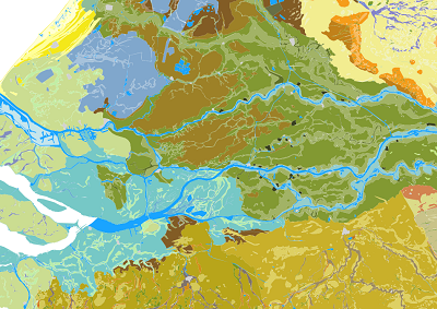
Op de Archeologische Landschappenkaart worden 26 landschappen onderscheiden en daarbinnen landschapszones. Deze zoneringen zijn niet alleen gebaseerd op landschappelijke kenmerken, maar ook op verwachte archeologische verschillen. Ze kunnen daarom helpen om archeologische verwachtingen toe te kennen. Daarnaast helpt de kaart om de juiste methoden en technieken te bepalen waarmee deze verwachte archeologische resten het beste kunnen worden opgespoord.
Status
- Disclosure level
- Restricted
- Available since
- Updated
Features
- Theme
- Culture and recreation
- High value
- Basic register
Ownership
- Source catalog
- Dexes marktplaats https://open.dexspace.nl
Contact
- Name
- Rijksdienst voor het Cultureel Erfgoed
- info@cultureelerfgoed.nl
Metadata
- Identifier
- https://nationaalgeoregister.nl/geonetwork?uuid=8c05d3ac-9709-49d8-bbcb-8979aede11aa
- Metadata language
- Dutch
Distributions (6)
Landschappenkaart_nl
accessPoint
- License
- Unknown license http://standaarden.overheid.nl/owms/terms/licentieonbekend Unknown license http://standaarden.overheid.nl/owms/terms/licentieonbekend
- Format
- OGC:WMS
- No policies are applicable for this dataset Ask for more information or send an access request
Policy
Landschappenkaartnl_hoofdlandschappen
accessPoint
- License
- Unknown license http://standaarden.overheid.nl/owms/terms/licentieonbekend Unknown license http://standaarden.overheid.nl/owms/terms/licentieonbekend
- Format
- OGC:WMS
- No policies are applicable for this dataset Ask for more information or send an access request
Policy
Landschappenkaart_nl
accessPoint
- License
- Unknown license http://standaarden.overheid.nl/owms/terms/licentieonbekend Unknown license http://standaarden.overheid.nl/owms/terms/licentieonbekend
- Format
- OGC:WFS
- No policies are applicable for this dataset Ask for more information or send an access request
Policy
Landschappenkaartnl_hoofdlandschappen
accessPoint
- License
- Unknown license http://standaarden.overheid.nl/owms/terms/licentieonbekend Unknown license http://standaarden.overheid.nl/owms/terms/licentieonbekend
- Format
- OGC:WFS
- No policies are applicable for this dataset Ask for more information or send an access request
Policy
Easy (dans)
Via EASY wordt de complete set van GIS-bestanden (shape, MapInfo) inclusief documentatie aangeboden.
- License
- Unknown license http://standaarden.overheid.nl/owms/terms/licentieonbekend Unknown license http://standaarden.overheid.nl/owms/terms/licentieonbekend
- Format
- HTML
- No policies are applicable for this dataset Ask for more information or send an access request
Policy
Gegenereerde grafische weergave
Dit is een grafische representatie van de dataset die via het NationaalGeoregister.nl aangeboden wordt.
Het is mogelijk dat deze grafische representatie geen weerspiegeling van de data is, maar dient als ondersteunende afbeelding. Indien de dataset via een OGC:WMS service aangeboden wordt, is het mogelijk om zelf een grafische weergave van de dataset te genereren.
- License
- Unknown license http://standaarden.overheid.nl/owms/terms/licentieonbekend Unknown license http://standaarden.overheid.nl/owms/terms/licentieonbekend
- Format
- PNG
- No policies are applicable for this dataset Ask for more information or send an access request