Overstroombaar gebied
Dataset
Description
Overstroombare gebieden zijn gebieden die normaal niet onder water staan, maar kunnen overstromen (tijdelijk onder water staan). Het gaat hierbij zowel om uiterwaarden die frequent onder water staan (buitendijks) als om beschermde gebieden achter de dijk (binnendijks). Beide vallen onder het toepassingsbereik van de Europese Richtlijn Overstromingsrisico's (ROR). In Overijssel gaat het om gebieden langs de IJssel, de Overijsselse Vecht, het Zwarte Water, het Zwarte Meer, het Ketelmeer, de Dinkel en om gebieden langs de aangewezen regionale keringen in het regionale watersysteem/regionale wateren (rivieren en kanalen). De kans op overstroming is 1 op 1000 jaren.
Status
- Disclosure level
- Restricted
- Available since
- Updated
Features
- Theme
- Water , Organisation and policy , Spatial planning
- High value
- Basic register
Ownership
- Source catalog
- Dexes marktplaats https://open.dexspace.nl
Contact
- Name
- Provincie Overijssel
- kennishub@overijssel.nl
Metadata
- Identifier
- https://nationaalgeoregister.nl/geonetwork?uuid=4ddb91d2-748c-4666-b6b1-f69512ddc691
- Metadata language
- Dutch
Distributions (8)
Ukst
UKST
- License
- Unknown license http://standaarden.overheid.nl/owms/terms/licentieonbekend Unknown license http://standaarden.overheid.nl/owms/terms/licentieonbekend
- Format
- Unknown
- No policies are applicable for this dataset Ask for more information or send an access request
Policy
Landingpage
landingpage
- License
- Unknown license http://standaarden.overheid.nl/owms/terms/licentieonbekend Unknown license http://standaarden.overheid.nl/owms/terms/licentieonbekend
- Format
- HTML
- No policies are applicable for this dataset Ask for more information or send an access request
Policy
B32_overstroombaar_gebied
OGC:WFS
- License
- Unknown license http://standaarden.overheid.nl/owms/terms/licentieonbekend Unknown license http://standaarden.overheid.nl/owms/terms/licentieonbekend
- Format
- OGC:WFS
- No policies are applicable for this dataset Ask for more information or send an access request
Policy
Ukst
UKST
- License
- Unknown license http://standaarden.overheid.nl/owms/terms/licentieonbekend Unknown license http://standaarden.overheid.nl/owms/terms/licentieonbekend
- Format
- Unknown
- No policies are applicable for this dataset Ask for more information or send an access request
Policy
B32_overstroombaar_gebied
OGC:WMS
- License
- Unknown license http://standaarden.overheid.nl/owms/terms/licentieonbekend Unknown license http://standaarden.overheid.nl/owms/terms/licentieonbekend
- Format
- OGC:WMS
- No policies are applicable for this dataset Ask for more information or send an access request
Policy
Ukst
UKST
- License
- Unknown license http://standaarden.overheid.nl/owms/terms/licentieonbekend Unknown license http://standaarden.overheid.nl/owms/terms/licentieonbekend
- Format
- Unknown
- No policies are applicable for this dataset Ask for more information or send an access request
Policy
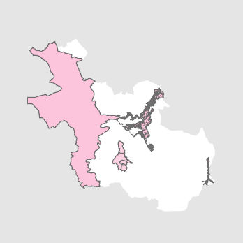
Gegenereerde grafische weergave
Dit is een grafische representatie van de dataset die via het NationaalGeoregister.nl aangeboden wordt.
Het is mogelijk dat deze grafische representatie geen weerspiegeling van de data is, maar dient als ondersteunende afbeelding. Indien de dataset via een OGC:WMS service aangeboden wordt, is het mogelijk om zelf een grafische weergave van de dataset te genereren.
- License
- Unknown license http://standaarden.overheid.nl/owms/terms/licentieonbekend Unknown license http://standaarden.overheid.nl/owms/terms/licentieonbekend
- Format
- JPEG
- No policies are applicable for this dataset Ask for more information or send an access request